After departing North Cascade National Park we headed toward Whidbey Island and hopped the ferry to the Olympic Peninsula. We swung through Port Angeles to pick up our backcountry permit at the Olympic National Park wilderness information center, and the next morning we hit the trail out to the Olympic Coast from Ozette. The “Ozette Triangle” makes for a nice overnight loop if you want to get a taste for the Olympic Coast. At just over 9 miles round trip it’s not too long, but far enough to leave a lot of the crowd behind and see a bit of wild coastline.
Here’s our video story of our backpacking trip to the Olympic Coast:
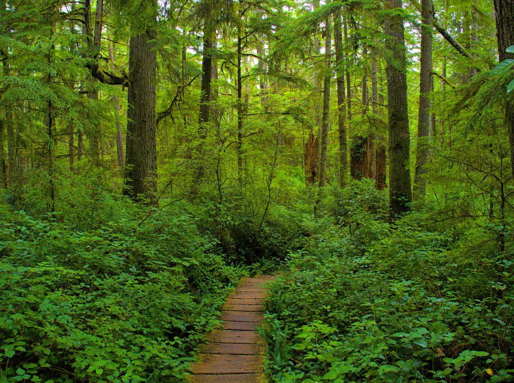
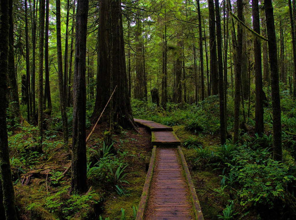
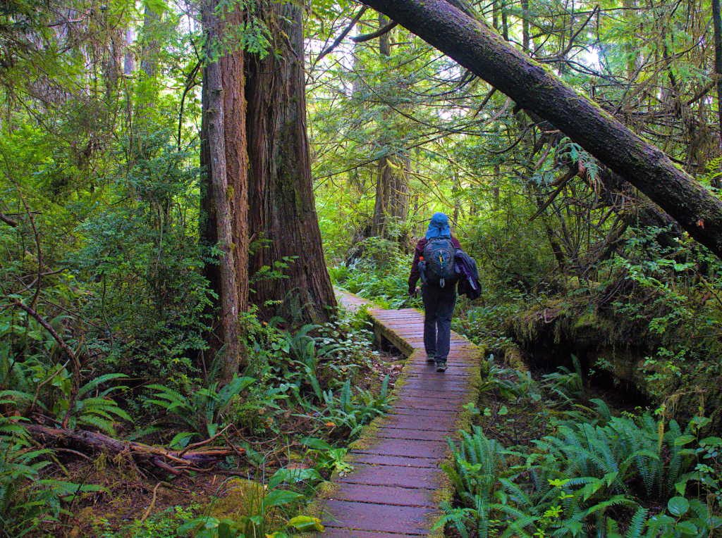
Both trails leading to and from the coast are well maintained. Two of the three legs of the triangle are the trail to the coast, the other leg of the triangle is the coastline. A lot of the trail length is actual elevated boardwalk. It rains here plenty and the park must have figured that boardwalks were the easiest way to keep the trail from being a muddy mess. I’m sure there is enough traffic on these trails to justify them as well. There was actually one segment of boardwalk that had to have gone on for about a mile.
We started our hike about mid day hoping to wait out the rain that had started overnight. We managed to stay dry on our three mile walk out to the coastline.
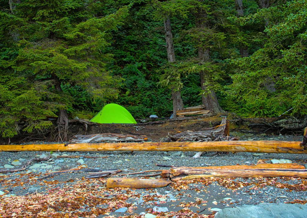
Once we reached the beach though, the misty air turned to a soaking light rain. Our permit allowed us to stay in the Wedding Rocks area, which is situated about halfway between the two trails that lead from Ozette out to the coast. So we made our way south for a mile in the misty rain.
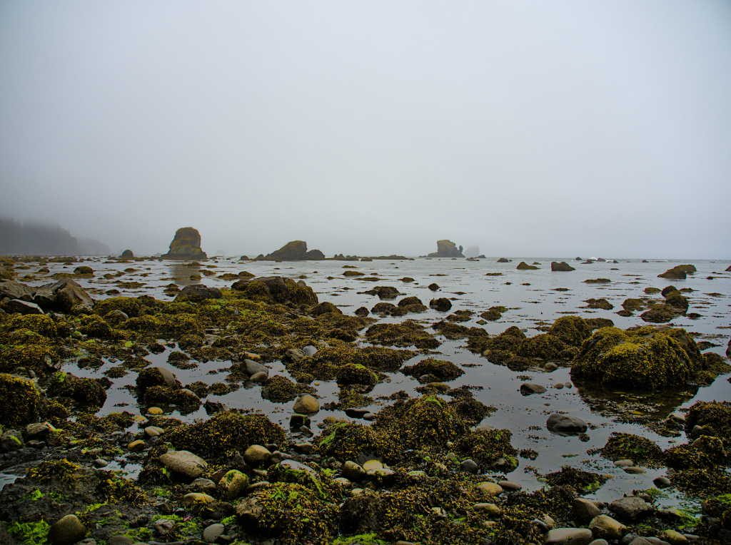
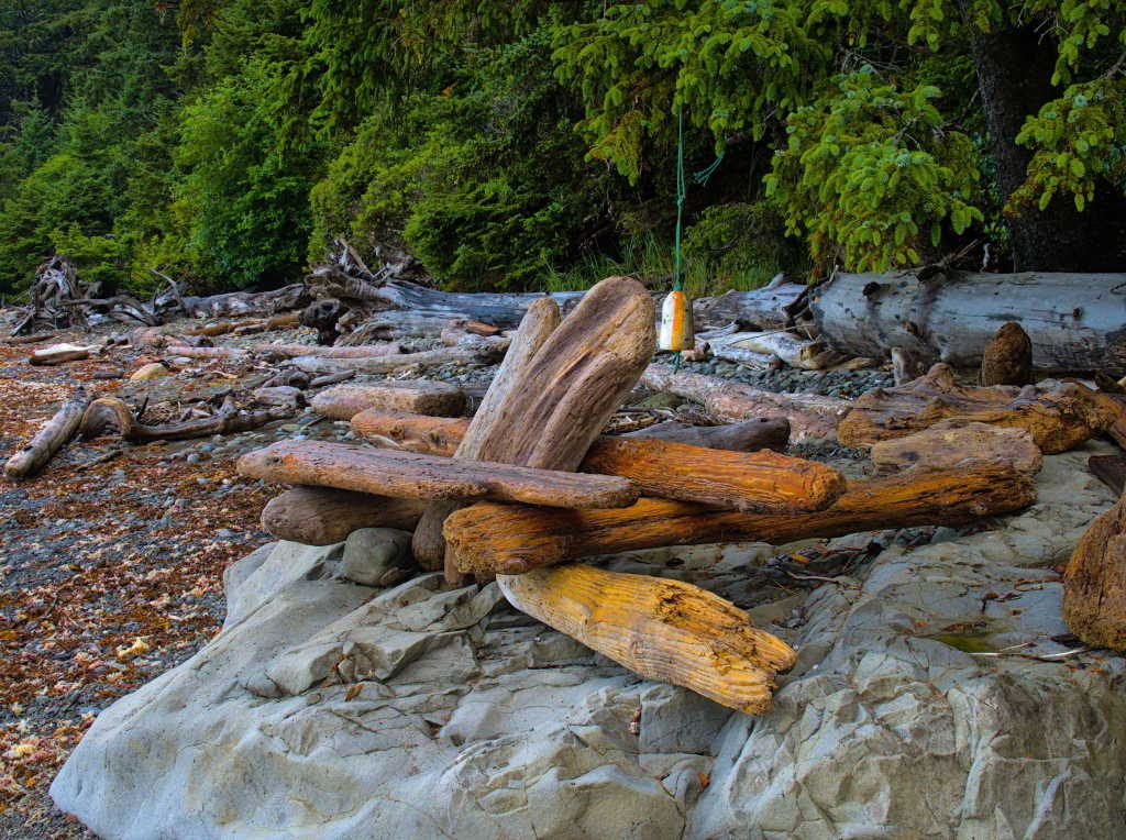
Walking on this beach is no easy stroll over broad expanses of white sand. Our mile walk south took us about an hour of navigating over wet, slimy cobbles and over and under large driftwood logs. As we approached Wedding Rocks we started to come across the camps tucked into the trees just above the shoreline.
In case you are thinking of going there and are wondering, there are camps both north and south of Wedding Rocks that are all part of the same backcountry permit area. I had asked about this at the wilderness “information” center, but was given an evasive answer that wasn’t really an answer at all. I would have preferred an “I don’t know” but instead got something completely unrelated about the trail over the headlands you can take at high tide. Oh well, not knowing the answer to all of your questions before you start a trip is all just part of the adventure.
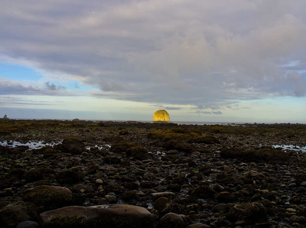
After a late lunch the rain clouds started to lift and a little more light was in the sky.
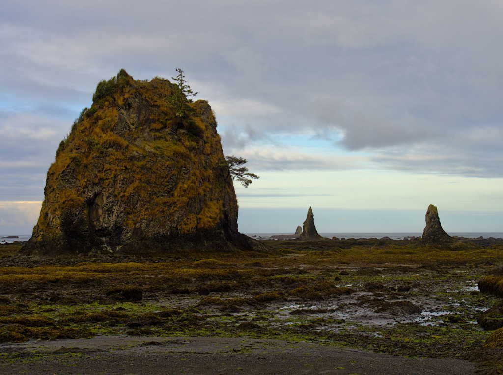
The tide was also on its way out, so we wandered the beach and looked around for the petroglyphs located at the rocks. Before too long we found them, or at least some of them. They are quite impressive. I believe this is the first time I’ve seen a whale petroglyph.
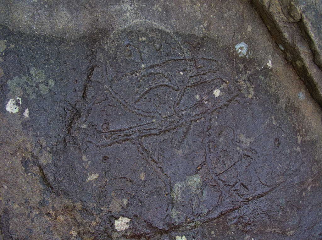
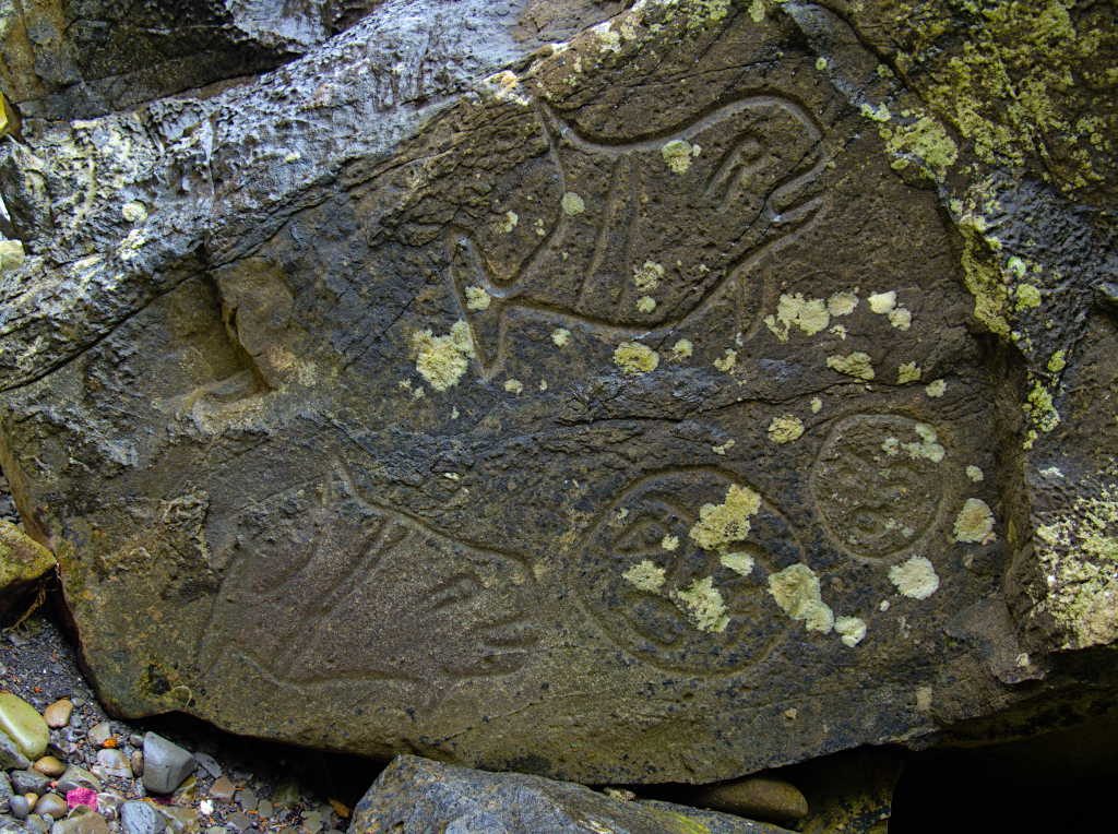
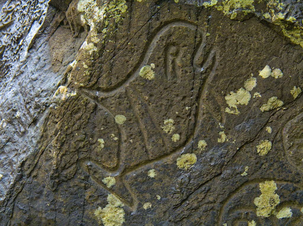
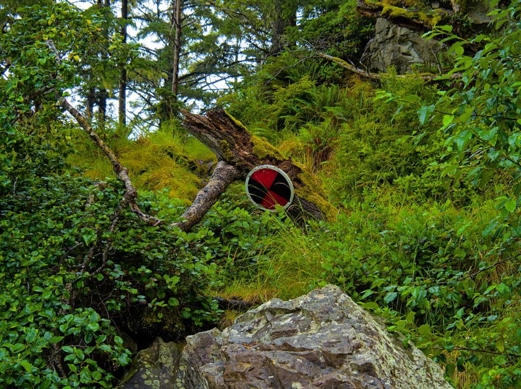
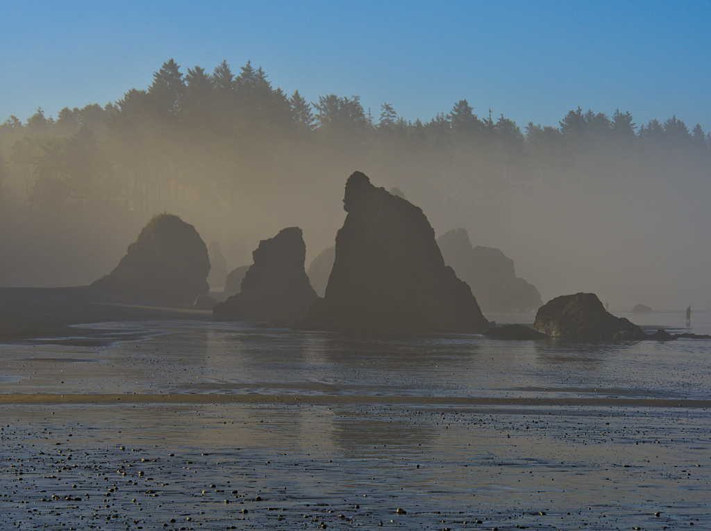
The Wedding Rocks are one of two obstructions that make walking the beach impassable at higher tides (above about 5′) along this section of the coast. There are bypasses where you can climb over the headlands if you need to get around them during those tides. The black and red Viking shield marks the spot. We were up early the next day so we didn’t have to use these bypasses.
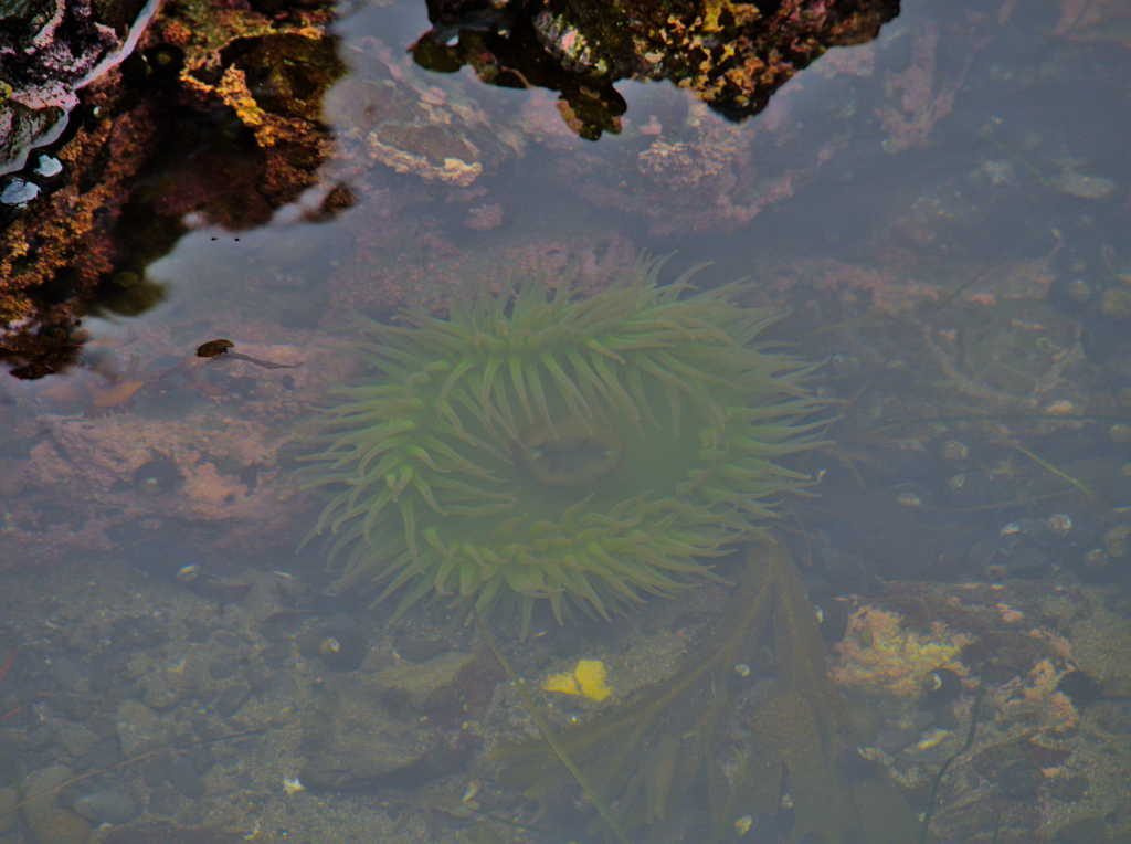
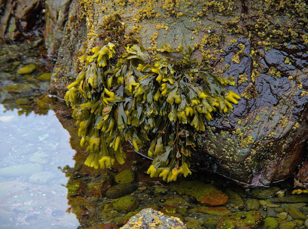
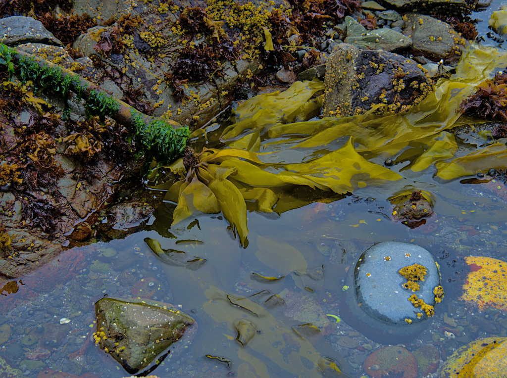
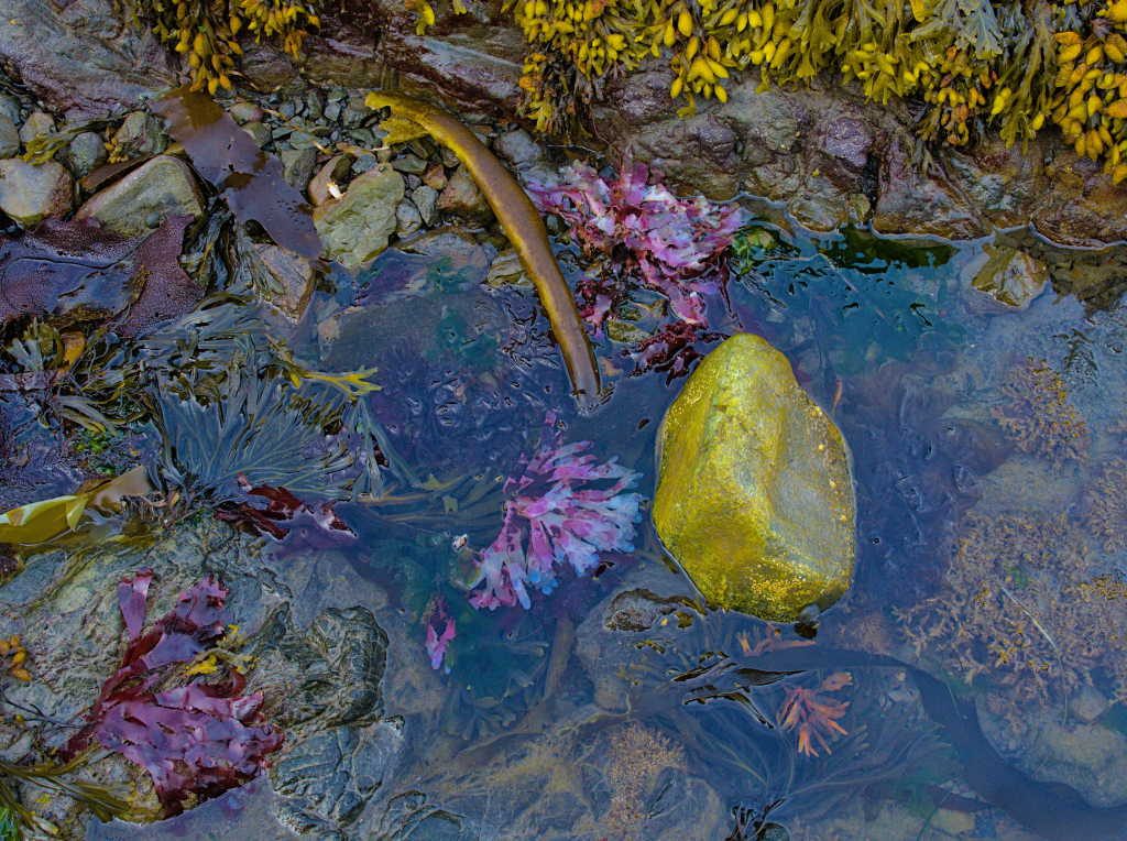
We wandered around the tidepools left behind as the tide went out. As most tidepools are, they were full of life.
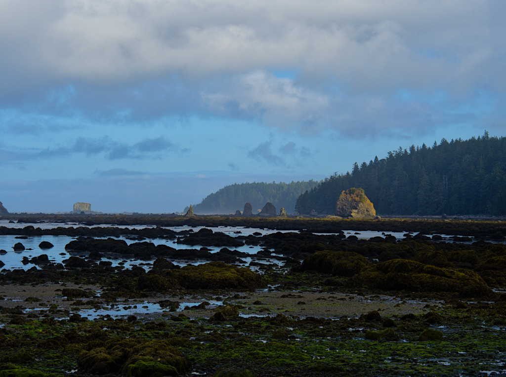
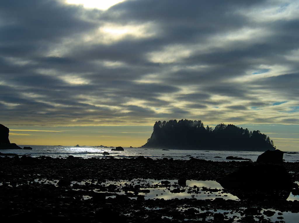
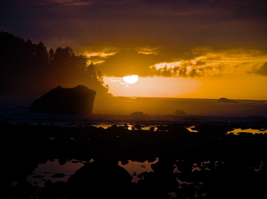
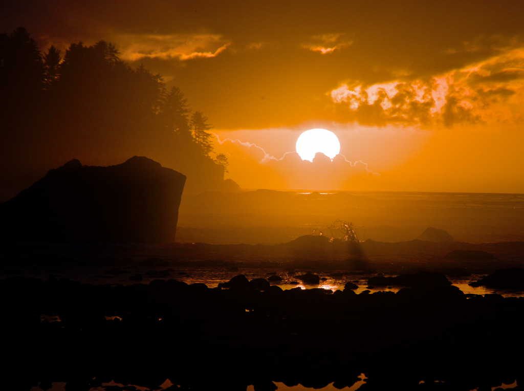
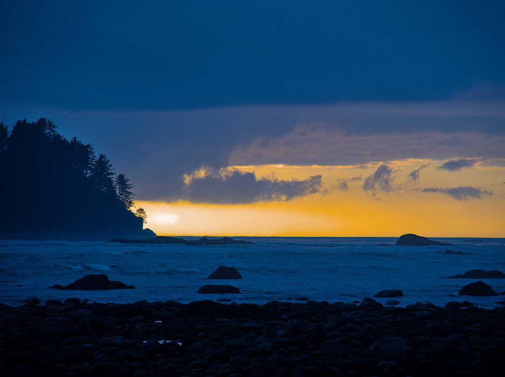
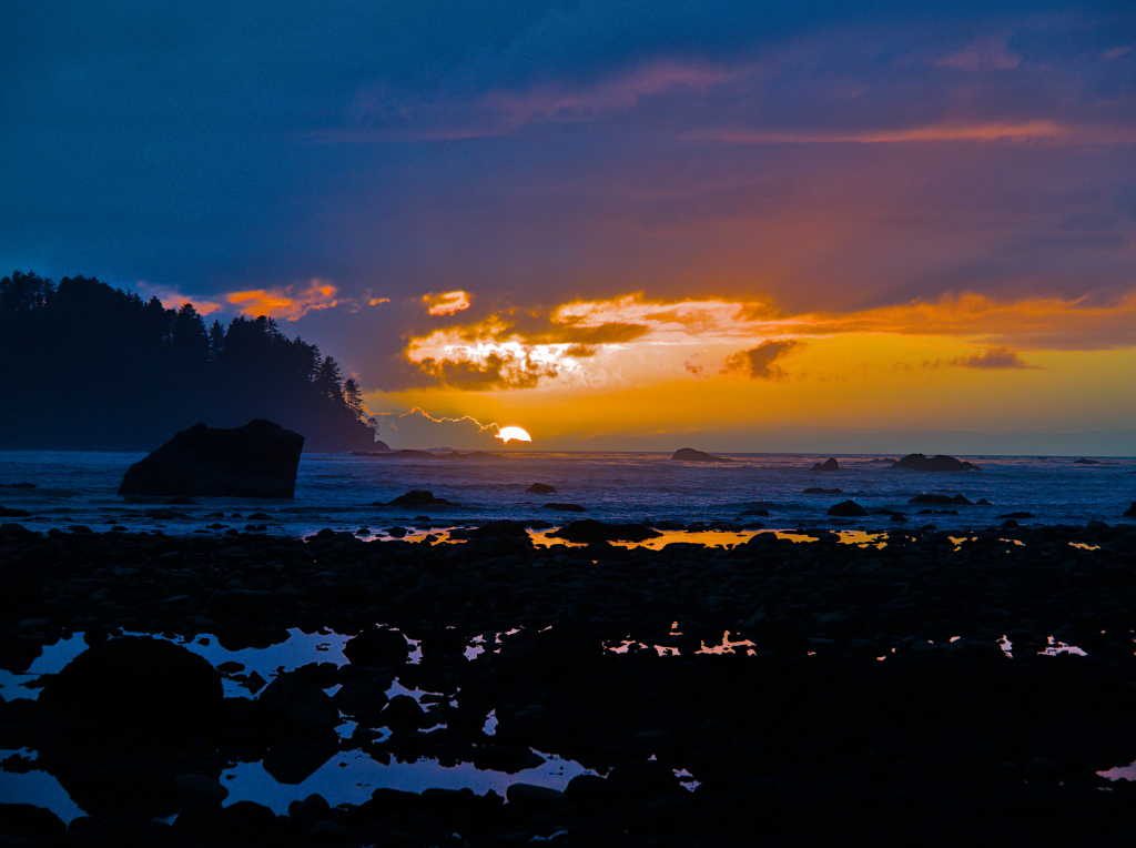
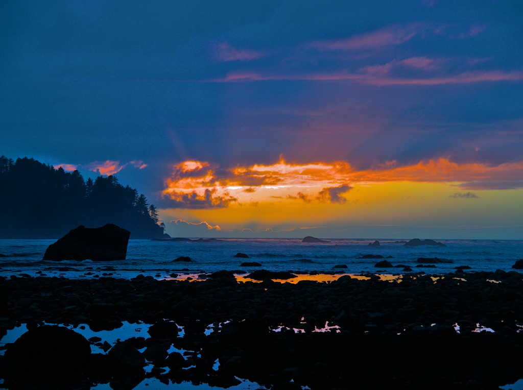
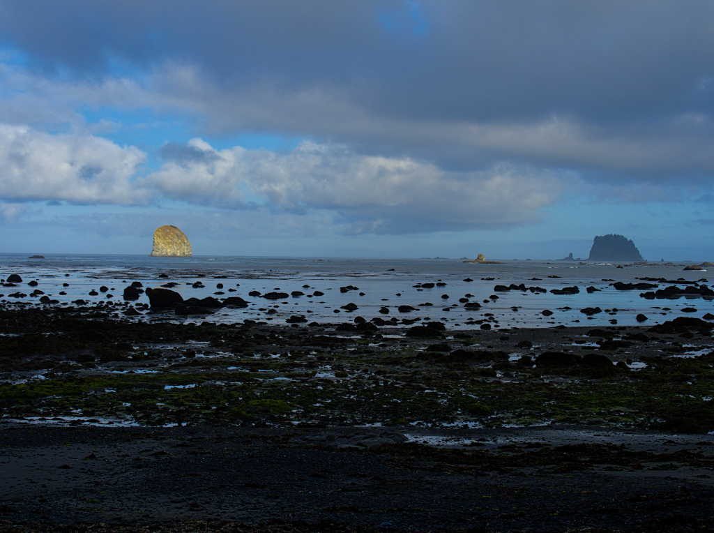
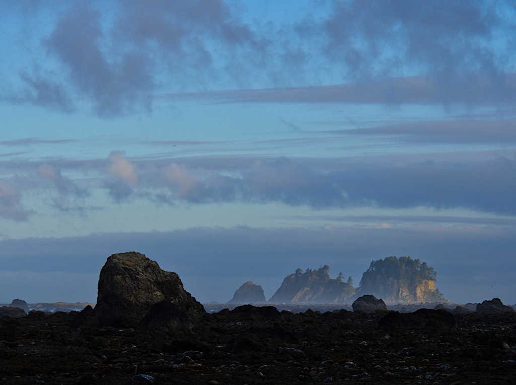
We were grateful that the weather was changing for the better, but a thick layer of clouds still floated above the offshore islands. We enjoyed dinner and what we thought was a ho-hum sunset. It wasn’t anything to write home about. It seemed the sun went from behind the clouds and slipped past the horizon behind a sea stack, and the daylight was quickly fading. So much for the dramatic coastal sunset we had hoped for. Just as it seemed like night was coming and it was time to head to the tent, the sun dropped out of the clouds and provided us with that dramatic sunset after all.
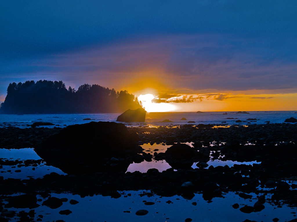
The light over the next ten minutes or so was impressive.
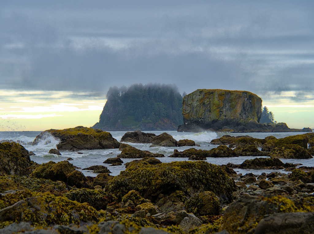
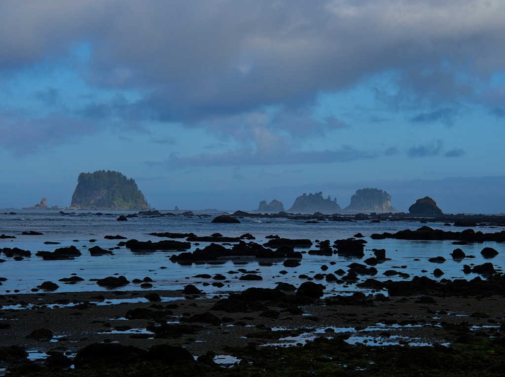
The next day we were up early to take advantage of the morning’s low tide. We mainly had the beach to ourselves.
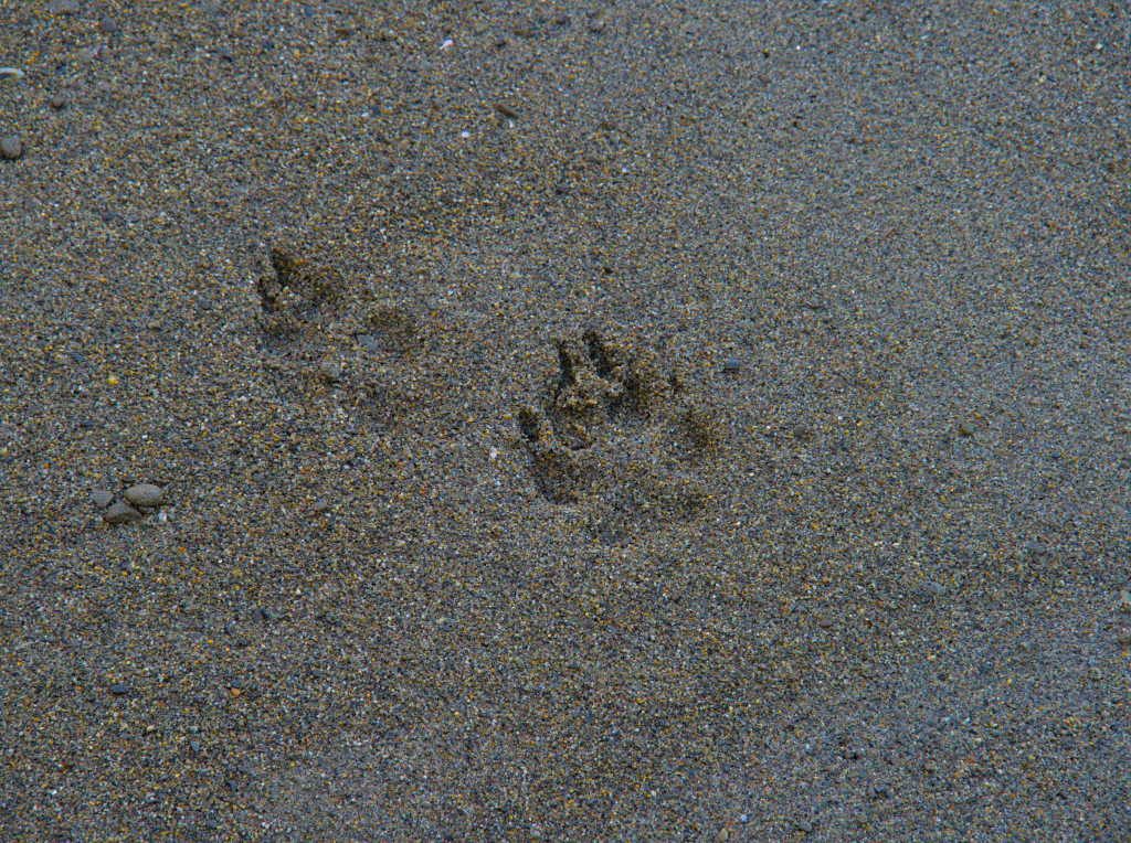
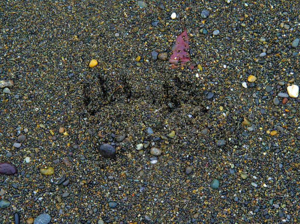
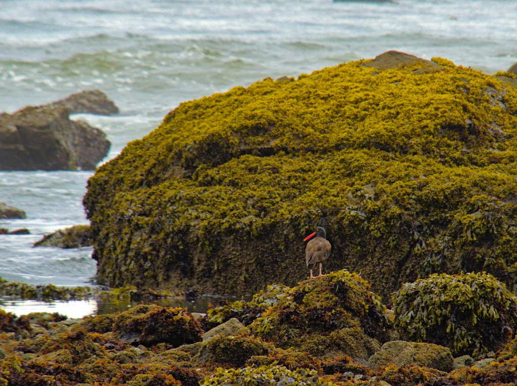
Mainly. We did see an otter bound out of the ocean and head into the tall shoreline grass. And there were signs of a coyote that had been on the beach right before us. And the pile of bear scat. And the bald eagle. But other than that, we had the beach to ourselves all the way to Sand Point, where we turned inland for our trip back to Ozette. Sand Point was packed with campers, so it was nice to see that once again, just going that extra mile gets you away from most of the sheeple.
There was really nice light on the sea stacks as the sun rose on a beautiful day.
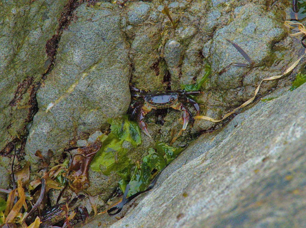
If only the crabs would have been a bit bigger…not much meat on these guys.
After our leisurely wander to Sand Point (it was much easier going than the previous day on this leg of the beach walk) it was time to leave the beach behind and see what the rest of Olympic National Park had in store for us.

Pingback: A Loop of Washington’s National Parks | Olympic National Park – Occidentalist